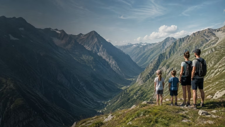
Hiking to Lac du Lauvitel in Écrins National Park

A detailed guide to help you prepare your outing, avoid unwelcome surprises and enjoy the best of Écrins National Park from Les 2 Alpes.

L2A-location2alpes-julia-hilton-hiver

Julia

Passionate Author – Blogger

Style, travel, inspiration: live every day with elegance and passion.​

LOCATION2ALPES · LOCAL GUIDE

Universe

Location2alpes

Collection

Alpine

Reading

6 min

Share

What to read in this guide

Check out the key points from this article to plan your trip, explore the area, and organize your outing to Les 2 Alpes.

01

Chapter 1

Essential things to know about the Lac du Lauvitel hike

02

Chapter 2

Access and planning from Les 2 Alpes

03

Chapter 3

Practical tips for a successful day out

04

Chapter 4

Precautions and final checks before you set off

What you need to know

Hiking to Lac du Lauvitel in Écrins National Park: practical tips, local advice and useful information to plan your stay in Les 2 Alpes

3-4 hrs
Average return time from the hamlet of La Danchère, excluding breaks – allow longer in summer or if you prefer a relaxed, discovery pace.
600 m
Total elevation gain. The climb is continuous after the hamlet, with no major technical difficulty but several sustained sections.
1,530 m
Lake altitude: it can be cool at the top, even in summer – suitable gear recommended.
15 min
Estimated driving time to the starting point from Les 2 Alpes, excluding seasonal traffic and parking time.

Introduction

Dreaming of reaching the famous Lac du Lauvitel, tucked away in the heart of Écrins National Park, from Les 2 Alpes resort? This hike attracts lovers of unspoilt nature, unique mountain views and rare authenticity every summer, but many visitors underestimate the logistics or the pitfalls of a route that is nevertheless very popular.

The aim of this guide is simple: to answer all your practical questions so you can prepare your day out with confidence, from the journey there to the final precautions to take on the morning you set off, and avoid the inconveniences that even experienced hikers sometimes encounter.

Whether you are going solo, with family or with friends, you will be able to assess the real difficulty of the route, organise your transfers, anticipate how the trail changes depending on the season and adopt the right logistical habits. Combined advice from locals and seasonal feedback will help you adapt your plans, avoid classic mistakes and make the most of this must-do hike in Oisans.

Throughout this guide, timed reference points, on-the-ground tips and useful links will help you prepare for a safe outing packed with scenery and enjoyment.

To plan ahead on this topic: Apartments to rent.

1
Essential things to know about the Lac du Lauvitel hike
2
Access and planning from Les 2 Alpes
3
Practical tips for a successful day out
4
Precautions and final checks before you set off

Chapter

01

Essential things to know about the Lac du Lauvitel hike

A detailed guide to help you prepare your outing, avoid unwelcome surprises and enjoy the best of Écrins National Park from Les 2 Alpes.

1
2
3
4

Difficulty level and who the hike is suitable for

The hike to Lac du Lauvitel is known for being accessible but physically demanding, ideal for motivated walkers, occasional hikers with good footwear, families with children already used to walking, and groups of friends looking for a change of scenery without technical risk.

The main factor to consider is the elevation gain: 600 m, mostly concentrated on the climb between La Danchère and the Lauvitel plateau. The trail winds through woodland before opening up as you gain altitude, with welcome shaded breaks in summer. The route has no exposed sections or technical obstacles (no ladders or vertiginous parts), but some stretches require good stamina and a basic level of fitness to enjoy the climb without struggling.

For families, it is advisable to wait until children are around 7-8 years old if they are not being carried, and to plan regular breaks: the climb can feel endless for younger walkers. Sportier hikers can aim for a brisk pace, but most visitors choose a walking pace, making the most of the route and its small points of interest (streams, viewpoints, flora).

Avoid going “light” without water or snacks, or planning a late return with tired children. Local feedback suggests that a half-day outing (morning or a relaxed afternoon) is ideal for enjoying the site and getting back calmly.

To compare accommodation options: Belle Etoile Jandri Les 2 Alpes.

The route starts in the hamlet of La Danchère, at an altitude of 980 m, just outside Venosc. The path first crosses the inhabited area before quickly entering the forest, following a fairly steady, well-marked slope. After a first series of bends through the woods, you will pass several water points (streams, damp sections), but note that tap-water supply is not guaranteed along the whole route.

Halfway up, the forest thins out to reveal scree slopes and a more open mountain landscape, with spectacular views of the ridges of the Parc des Écrins as you approach the lake. Some rocky sections can be slippery after rain: at minimum, grippy low-cut hiking shoes are recommended, or higher boots if carrying a child.

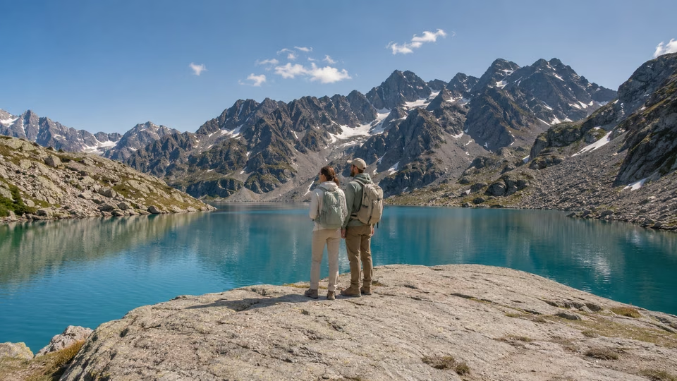
Also be aware of small rockfalls early in the season or during snowmelt, and of temporary restrictions when trail repairs are under way (check with the Parc des Écrins before setting off). The lake itself feels like a reward at the top, with banks that are perfect for relaxing. Swimming is prohibited by decree in order to protect the ecosystem – please respect the peace and quiet of the site, especially as it can be busy between 10am and 4pm in high season.

In short: accessible but physical profile, mountain environment, and the importance of proper equipment and following Parc des Écrins guidance.

To find other suitable activities: Les 2 Alpes BLOG.

Route features and key points to watch

To choose the best time slot, opt for an early start, which gives you cooler temperatures and a quieter climb. This also helps you avoid the main flow of walkers between 10am and 2pm, while the forest section offers less shade in the afternoon.

Local tip: if you are unsure about the group’s level, walk up to the first clearing (around 45 minutes on foot): it already gives you a taste of the finest views and allows less experienced walkers to turn back without frustration. If you are hesitating, morning weather is usually the best option: in drizzle or rain, the climb remains possible, but the stones can be slippery and the lake less spectacular.

More on this topic: Hike to Lac du Lauvitel in the Parc des Écrins.

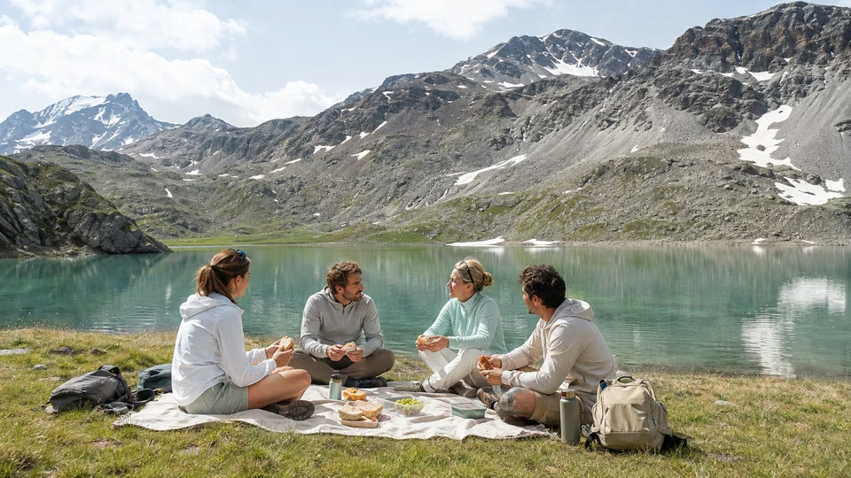
Before setting off, check the latest trail conditions: snowmelt, possible works or summer storms can affect accessibility. It is recommended to consult the updated Parc des Écrins page and read the latest guidance. If the hike is your only plan for the day, allow plenty of time so you are not racing the clock: the magic of Lauvitel is also best enjoyed by taking time to admire the scenery or enjoy a proper picnic break by the lake.

Also worth discovering: Discover the Parc des Écrins and the Oisans Massif with the Family.

On this page

01

Essential things to know about the Lac du Lauvitel hike

02

Access and planning from Les 2 Alpes

03

Practical tips for a successful day out

04

Precautions and final checks before you set off

Extend the experience

raclette_parfaite_hero-1
Perfect raclette: secrets and tips for a successful meal
plats_savoyards_oublies_hero-1
Savoyard cuisine: 4 must-try dishes
genepi_des_alpes_hero-1
Alpine Génépi: Tips and Recipes
randonnee_lac_du_lauvitel_hero-1
Lac du Lauvitel Hike in Écrins National Park
que_faire_aux_2_alpes_quand_il_fait_chaud_hero-1
What to do in Les 2 Alpes when it’s hot?

The Resort Guide

Plan your trip by exploring the must-see attractions in Les 2 Alpes: activities, scenery, practical tips, and top spots to help you make the most of your time at the resort.

An exceptional estate

Chapter

02

Access and planning from Les 2 Alpes

A detailed guide to help you prepare your outing, avoid unwelcome surprises and enjoy the best of Écrins National Park from Les 2 Alpes.

1
2
3
4

How to reach the starting point: options and timetables to check

The “classic” starting point for the trail is in the hamlet of La Danchère (Venosc municipality), around 15 minutes by car from Les 2 Alpes — allow longer if you are travelling by shuttle or during peak season.

By car: from the centre of the resort, drive down to Venosc via the D220, then follow signs for “La Danchère”. Parking is free and available in two small car parks: the main one in the heart of the hamlet (often full by 9:30am in summer) and a smaller secondary car park near the access road.

By shuttle: in the summer season, Les 2 Alpes runs a gondola link (Venosc Express) between the village of Venosc and the resort centre (check times: first departure at 9am, last return depending on how busy it is, with updated information on the resort website). From Venosc, you will still have 1.5 km to cover on foot or by local shuttle to La Danchère — allow 20 to 30 minutes’ walking depending on your luggage or the pace of your group.

Good to know: during very busy periods or if the gondola is exceptionally closed (storm, maintenance work), plan an alternative option such as car sharing or a local taxi transfer. Also make sure you time your return carefully so you do not miss the last gondola if you are staying in Les 2 Alpes.

Read also: Hiking around Les 2 Alpes: discover the best trails.

Parking in La Danchère is the main organisational challenge: spaces are limited (around thirty in the main car park and about a dozen in the secondary one) and fill up quickly at weekends in July and August.

Local tip: if you arrive after 9:30am, plan to park lower down, at the entrance to Venosc or in the gondola car park. This adds around 20–25 minutes to your walking time but makes your return more secure.

Outside peak season, the trail is usually accessible once the snow has melted (generally in May, depending on the weather and the year’s snowmelt). Take care: significant snow patches can remain on the upper section of the route until June, and some stretches may be temporarily closed for park works or restoration.

In the event of the unexpected — a storm, or a trail closure announced at the entrance or on the park website — it is strongly recommended to have a backup walk in mind, such as the Muzelle waterfall or the nearby Plan du Lac trail. In all seasons, check the weather forecast and any warnings issued by the Parc des Écrins the day before to avoid disappointment on the day.

To help plan the rest of your stay: Wellness in Les 2 Alpes: best places to go.

Parking, seasonal access and alternatives if plans change

Make sure you estimate your journey time from Les 2 Alpes properly: on weekdays traffic is usually smooth, but on sunny peak days and during the 14 July to 15 August period, traffic on the small road between Venosc and La Danchère can increase significantly.

Do not overlook the return timetable either: depending on the year, the last Venosc Express gondola may be brought forward due to storms or technical checks. By allowing a generous return margin — at least 45 minutes before the final run — you can get back to Les 2 Alpes without stress, especially if you are delayed on the hike.

See also: Hike to the Lac and Refuge de la Muzelle.

If you choose a motorised transfer, such as a local taxi or car sharing, book no later than the day before during peak season: the hamlet has limited capacity, and on some days the Venosc shuttle does not run outside the gondola up/down operating times.

Finally, bear in mind that in some years, health or environmental restrictions such as forest fires or severe drought can change access arrangements. To stay up to date, always check the official Les 2 Alpes resort website for lift and seasonal shuttle information, as well as the Parc National des Écrins conditions page for trail status, alerts and closed areas.

Another useful resource: official Les 2 Alpes website.

On this page

01

Essential things to know about the Lac du Lauvitel hike

02

Access and planning from Les 2 Alpes

03

Practical tips for a successful day out

04

Precautions and final checks before you set off

Extend the experience

3600 m

Elevation of the Les 2 Alpes Glacier

Live Weather
Les 2 Alpes
--°C
Loading...
Wind -- km/h

Going Out in Les 2 Alpes

“The best restaurant isn't always the one with the highest rating”
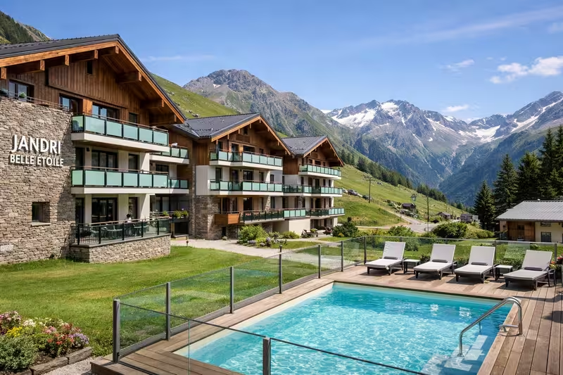
Belle Etoile Jandri les 2 alpes

Stay

A Summer in the Great Outdoors

Discover the best summer activities in Les 2 Alpes: hiking, mountain biking, high-altitude lakes, panoramic views, and mountain adventures to make the most of your stay.

Chapter

03

Practical tips for a successful day out

A detailed guide to help you prepare your outing, avoid unwelcome surprises and enjoy the best of Écrins National Park from Les 2 Alpes.

1
2
3
4

What gear to bring depending on the season and weather

To make the most of your hike to Lac du Lauvitel, it is essential to adapt your kit to the weather and the time of year. From spring onwards, melting snow can make the trail damp or even slippery: choose high-cut hiking boots with grippy soles, preferably waterproof. In summer, temperatures can rise, but mornings remain cool in the Vénéon valley — a light fleece and a waterproof or windproof jacket are recommended.

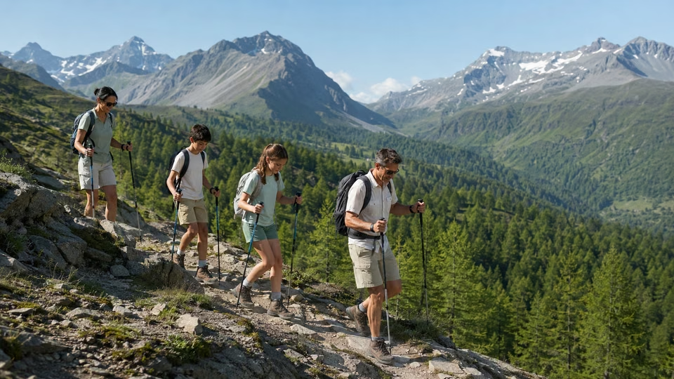
Never overlook sun protection (sunglasses, hat, high-protection sunscreen), even if the climb through the forest seems shaded. A 20–30L backpack is ideal for carrying a picnic, water (allow at least 1.5 to 2L per person, as there is no reliable drinking water point on the route), and perhaps walking poles, which are useful for the descent. In autumn, rain is not uncommon: opt for quick-drying clothing and pack an emergency blanket in case it turns unexpectedly cold. Finally, do not forget an IGN map or the Parc national des Écrins app, in case your phone battery fails.

The time shown at the start (around 1 hr 30 to 2 hrs for the climb, 1 hr 15 to 1 hr 30 for the descent) can quickly increase depending on the season and how busy the trail is. Locals recommend setting off early, especially in summer or at weekends, to reduce waiting time at the car park in the hamlet of La Danchère and enjoy the peace of the path before the crowds arrive.

Plan your main break for when you reach the lake, but take time to pause halfway up in the sunny clearings or near the footbridges over the Vénéon: they make useful landmarks and will help you pace your effort. As for water, don’t wait until you feel thirsty before drinking regularly, especially in hot weather. There is no refuge or fountain along the route — filling your water bottle in the village before setting off is essential.

Finally, keep an eye on Park alerts: in high season, part of the trail may be temporarily diverted, adding to the walking time. Word of mouth between hikers can be a valuable source of live information on trail conditions or muddy sections to avoid.

Local tips: realistic ascent time, breaks and managing water

Insider tips all point in the same direction: preparing your Lauvitel hike as a proper little adventure will go a long way towards making the day a success. As well as your backpack and hydration, think about waste management — all rubbish must be carried back down with you, as the site lies in the core area of the national park and is closely monitored. A waste pouch, a few freezer bags and biodegradable toilet paper are recommended, along with a small first-aid kit for minor issues such as blisters, scratches and insect bites.

For those who want to capture the beauty of the site, a camera or smartphone will have endless opportunities to shine, but take a waterproof pouch in case of rain or damp crossings. Finally, check the periods and times when swimming or picking plants is regulated, so you don’t risk a fine.

On very busy days, take a few minutes to chat with hikers you meet or with Park teams — they often know how the terrain is changing and are usually happy to share their observations. Set off with peace of mind, but stay alert to the unexpected changes that can come with mountain weather, sometimes within half a day. Even without any major technical difficulty, the Lauvitel hike calls for care and flexibility: don’t be afraid to turn back in bad weather or if you feel tired. The enjoyment will still be there on a future visit.

On this page

01

Essential things to know about the Lac du Lauvitel hike

02

Access and planning from Les 2 Alpes

03

Practical tips for a successful day out

04

Precautions and final checks before you set off

Stay tuned on Location2alpes

A Live Preview

to get a sense of what to expect before coming to Les 2 Alpes

Updated data

24 hours a day, nonstop

8 Strategic Perspectives

about the resort, the glacier, and the peaks

Useful all year round

winter, summer, weather, events, ...

The Flavors of Les 2 Alpes

Cozy dining, mountain cuisine, terraces with panoramic views, and welcoming spots: explore our top recommendations for great dining in Les 2 Alpes.

Inspirations

“The best memories are rarely planned.”

— Local Guide

Chapter

04

Precautions and final checks before you set off

A detailed guide to help you prepare your outing, avoid unwelcome surprises and enjoy the best of Écrins National Park from Les 2 Alpes.

1
2
3
4

Pre-hike checklist: essential things to check

Before leaving Les 2 Alpes or Bourg d’Oisans, do one final check of the weather (ideally on www.meteo.fr or the dedicated page of the Écrins National Park) and the trail opening status (the official park website or local notices in La Danchère). Make sure you have forgotten nothing: dry shoes, rain jacket, water, food, a map or charged phone, ID if needed for the car park, and cash for a possible snack on the way.

Available free of charge, the local checklist from the Venosc-La Danchère Tourist Office pays particular attention to planning the return, as nightfall in the mountains can come as a surprise in autumn or after a late start. Let someone locally know about your hiking plans too, especially if you are setting off alone, and take a moment to set your watch to local time. A head torch or small lamp is also recommended, even in good weather.

To keep your experience safe, a few websites and apps are essential before and during the hike:

  • Écrins National Park website: regularly updates the condition of paths, closures due to works or natural hazards, and provides access to wildlife alerts (ibex presence, sensitive areas).
  • Météo-France: the mountain section gives you hour-by-hour information for the Vénéon valley and the Lauvitel massif.
  • Rando Ecrins app: daily recommendations, downloadable GPX tracks, feedback from other hikers and updated photos


Don’t hesitate to call Venosc town hall or the Park visitor centre for the latest practical information.

Official information and useful links for weather and conditions

One final point of caution concerns dogs: even on a lead, they are prohibited in the Lauvitel reserve in the core area of the Park. Pay close attention to local regulations; plant picking and swimming are limited depending on the period, and access to the trail may be subject to quotas at the very start of summer to protect the natural environment. Mobile phone coverage is generally weak along the route; let your loved ones know and keep the mountain emergency number (112) close at hand.

Giving yourself the best chance of a hike with no unpleasant surprises often means accepting a certain discipline before you set off. But it also ensures you can fully relax once you are there and enjoy the fresh air and Lauvitel panoramas. Prepare carefully, but leave room for discovery too: the mountains will reward your vigilance with precious memories.

On this page

01

Essential things to know about the Lac du Lauvitel hike

02

Access and planning from Les 2 Alpes

03

Practical tips for a successful day out

04

Precautions and final checks before you set off

Location2Alpes Collection

Places we love to return to

Apartments selected for their location, comfort, and atmosphere, so you can enjoy Les 2 Alpes with complete freedom.

Best Mountain Biking Spot in the Alps

Plan Your Trip
to Les 2 Alpes

Discover our apartments, ideally located so you can make the most of your stay

Continue the adventure

Les plus beaux souvenirs commencent souvent après le dernier conseil

LOCATION2ALPES · LOCAL GUIDE

Conclusion

Preparing a hike to Lac du Lauvitel from Les 2 Alpes requires both planning and flexibility: you are now ready to tackle each stage with confidence. With a clear understanding of the real difficulty level, the trail profile and the access points, you can adapt your equipment, plan the breaks you need and organise your logistics without stress. It is essential to check the weather, anticipate crowds, identify accessible car parks and update your information via the official Écrins National Park sources before setting off.

Your experience on this iconic trail will depend largely on your preparation. Pay particular attention to the small things people often forget: water, sun protection, snacks, and clothing suited to changing weather conditions, as well as seasonal or occasional trail closures. Stay flexible: if the weather is poor or car parks are full, keep alternatives in mind, such as changing your start time, finding another access point or choosing a backup route.

Solo hike, family outing or trip with friends: every group can enjoy Lauvitel, provided you assess everyone’s fitness levels and limits properly. Speak to locals whenever possible, as they often share tips that are missing from standard guidebooks.

Finally, enjoy every moment at Lac du Lauvitel: exceptional views, protected wildlife and flora, pure Écrins mountain air and, above all, the satisfaction of having experienced it with confidence and independence.

What's next? Choose your next step

1
Essential things to know about the Lac du Lauvitel hike
2
Access and planning from Les 2 Alpes
3
Practical tips for a successful day out
4
Precautions and final checks before you set off

Key Points

The right choice depends on the pace of your trip and what you're looking for.

Keep your options open for impromptu evenings out.

A well-located place to stay makes dining out and getting around easier.

Practical information

Season: Summer / Winter

Reading time: 6 min

Area: Les 2 Alpes

Altitude : 1,650 m

Audience: Families, Couples, Groups

Live webcams

LES 2 ALPES

The Glacier

3,400 m above sea level

8 HD webcams

Continuous Updates

Check the weather all year round

Check out the weather, snow conditions, and atmosphere at the resort in real time.

LOCATION2ALPES · LOCAL GUIDE

Frequently asked questions

Find answers to the most common questions about our products. Julia ensures transparency, efficiency, and detailed information in everything we do.

How difficult is the hike from Les 2 Alpes?
The hike to Lac du Lauvitel, starting from the village of Bourg d’Arud near Venosc (the classic starting point accessible from Les 2 Alpes), is moderately difficult. Allow around 2 to 2.5 hours for the ascent, with 600 m of positive elevation gain on a trail that is mainly in forest, with a few stony sections. This route is suitable for occasional hikers in good physical condition, but remains demanding for children or less sporty walkers. Plan regular breaks to enjoy the scenery and manage your effort.
How do I reach the trail if I am staying in Les 2 Alpes?
From Les 2 Alpes, you need to go down to Venosc by gondola lift in season, or by road outside operating hours. From Venosc, head to Bourg d’Arud, the starting point for the waymarked trail to Lac du Lauvitel. Always check the seasonal opening of the gondola before you leave and aim for the car park at Bourg d’Arud, which is often full in peak season. If it is busy, a very early start or parking in Venosc with a little extra walking can be a smart option.
What are the common risks or pitfalls on this hike?
The main pitfalls to avoid are not carrying enough water, as there is no supply point on the trail, underestimating the weather, including fog, sudden rain and summer storms, and being tempted to start late, when the route is busier and hotter. Bear in mind the possibility of temporary closures due to fallen trees, trail works or torrent flooding. Always check the Écrins National Park website and plan your return from the hike so you do not miss the last connection or get caught out by the weather.
What equipment should I take for a good Lauvitel hike?
Choose hiking shoes with grippy soles and a light but complete backpack: enough water, 1.5 to 2 litres per person, a windbreaker, fleece or rain jacket depending on the season, sunglasses and sun cream, a hat or cap, and savoury and sweet snacks. Add an IGN map or route guide, or a hiking GPS app, a charged phone and, ideally, walking poles, which are recommended for the descent, as it can be steep and slippery in places. Do not overload your pack unnecessarily and adapt your gear to the day’s weather.
What official information should I check before setting off?
Check the official Écrins National Park website for current alerts: trail conditions, seasonal closures, temporary bans or special regulations, including protected wildlife, dogs on a lead and no bivouacking. Also check the weather forecast, via Météo France or local apps, and transport times, such as the Venosc - Les 2 Alpes gondola or any shuttle services. These checks help avoid unpleasant surprises and keep you safe whatever the time of year.
L2A-location2alpes-julia-hilton-blog
Find the answer to your question
LOCATION2ALPES · LOCAL GUIDE

Local Guide

LOCATION2ALPES · LOCAL GUIDE

Find the best moments from your article
Essential things to know about the Lac du Lauvitel hike
randonnee_lac_du_lauvitel_section_1
Access and planning from Les 2 Alpes
randonnee_lac_du_lauvitel_section_2
Practical tips for a successful day out
randonnee_lac_du_lauvitel_section_3
Precautions and final checks before you set off
randonnee_lac_du_lauvitel_section_4

The Location2alpes Blog

Discover tips, trends and ideas to help you prepare for your stay in the mountains, and discover fantastic places and addresses. Julia and the team regularly prepare new articles for you, so don't hesitate to visit our blog regularly.

Latest articles:

ou_manger_aux_2_alpes_en_hiver_hero-1
Where to eat in Les 2 Alpes in winter
les_2_alpes_5_restaurants_incontournables_hero-1
5 must-try restaurants in Les 2 Alpes
randonnee_lac_et_refuge_de_la_muzelle_hero-1
Hike to Lac de la Muzelle and the Muzelle refuge
plus_jolie_station_alpes_vacances_ete_hero-1
What is the prettiest Alpine resort for a summer family holiday?
cuisine_savoyarde_hero-1
Savoyard Cuisine: 12 Must-Try Specialities to Taste at Least Once

What would you like to explore ?

Get quick access to the resort's highlights, activities, top spots, and practical tips to help you plan your trip.

Scroll to Top