


- BLOG LOCATION2ALPES.COM
Hike to Lac de la Muzelle and the Muzelle Refuge
Everything you need to know to make the most of the Muzelle hike, avoid mistakes and unexpected issues, whatever your experience level or the season.

Universe
Location2alpes
Collection
Alpine
Reading
6 min
Share
What to read in this guide
Check out the key points from this article to plan your trip, explore the area, and organize your outing to Les 2 Alpes.
What you need to know
Hike to Lac de la Muzelle and the Muzelle refuge: practical tips, local advice and useful information to plan your Les 2 Alpes holiday
Introduction
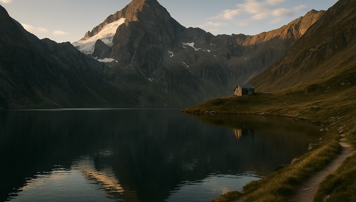
Preparing a hike to the lake and refuge de la Muzelle is about much more than following a trail: it means planning your adventure around your abilities, the time available and real mountain conditions. Between the desire for breathtaking views, the appeal of a night in a mountain refuge and the need to avoid the traps of an underestimated hike, the route requires a genuinely informed choice.
This guide focuses above all on practical advice, access options, weather specifics and the key points to watch so you can make the most of this outing in the heart of the Écrins massif. It is neither a wild route reserved for seasoned adventurers nor an easy tourist stroll: the Muzelle can become the highlight of your stay, provided you prepare your route properly, take the constraints into account and leave nothing to chance.
Whether you are an occasional hiker, a nature lover or an experienced walker, you will find up-to-date, seasonally relevant information here, along with the right questions to ask when planning an adventure that is both demanding and accessible.
Follow our advice to avoid the main pitfalls and enjoy a well-balanced hike that matches your expectations.
To plan ahead: Apartments to rent.
Chapter
01
Discover the hike to Lac de la Muzelle and the Muzelle Refuge
Everything you need to know to make the most of the Muzelle hike, avoid mistakes and unexpected issues, whatever your experience level or the season.
Levels and hiker profiles: who is this route for?
The hike to the lake and refuge de la Muzelle appeals both to walkers looking for spectacular mountain views and to those seeking a first experience in a mountain refuge. However, it is essential to understand your expectations and fitness level before setting out on this famously demanding route.
For occasional hikers, the first few kilometres may feel manageable, but the climb becomes steadily more challenging once you leave the forests, with sections requiring sustained effort. Sporty families with teenagers can consider doing this as a day hike, provided they already have experience of hiking with significant elevation gain (between 900 and 1,200 m depending on the starting point). Younger children will need close support and plenty of motivation to keep going, as the scenery changes little in the woodland before the final reveal of the lake.
Regular walkers will enjoy the route through a protected natural environment, with the reward of an authentic and often lively refuge during the summer season. Beginners, or anyone not used to mountain walking, should carefully assess their stamina, as the return follows the same trail and involves a long, technical descent.
Finally, committed nature lovers can include the Muzelle as a stage in a more ambitious trek, such as the Vénéon lakes circuit, but must be prepared for weather conditions that can change suddenly and for the need to book the refuge as soon as the season is in full swing.
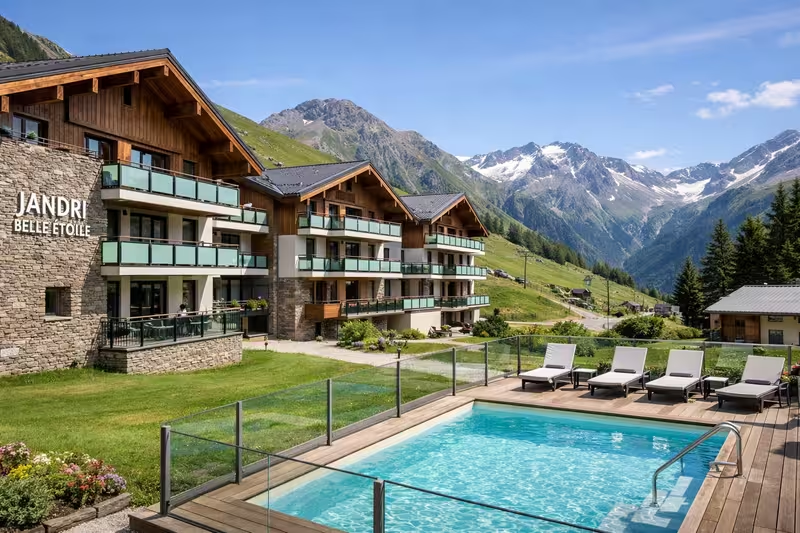
To compare options: Belle Etoile Jandri Les 2 Alpes.
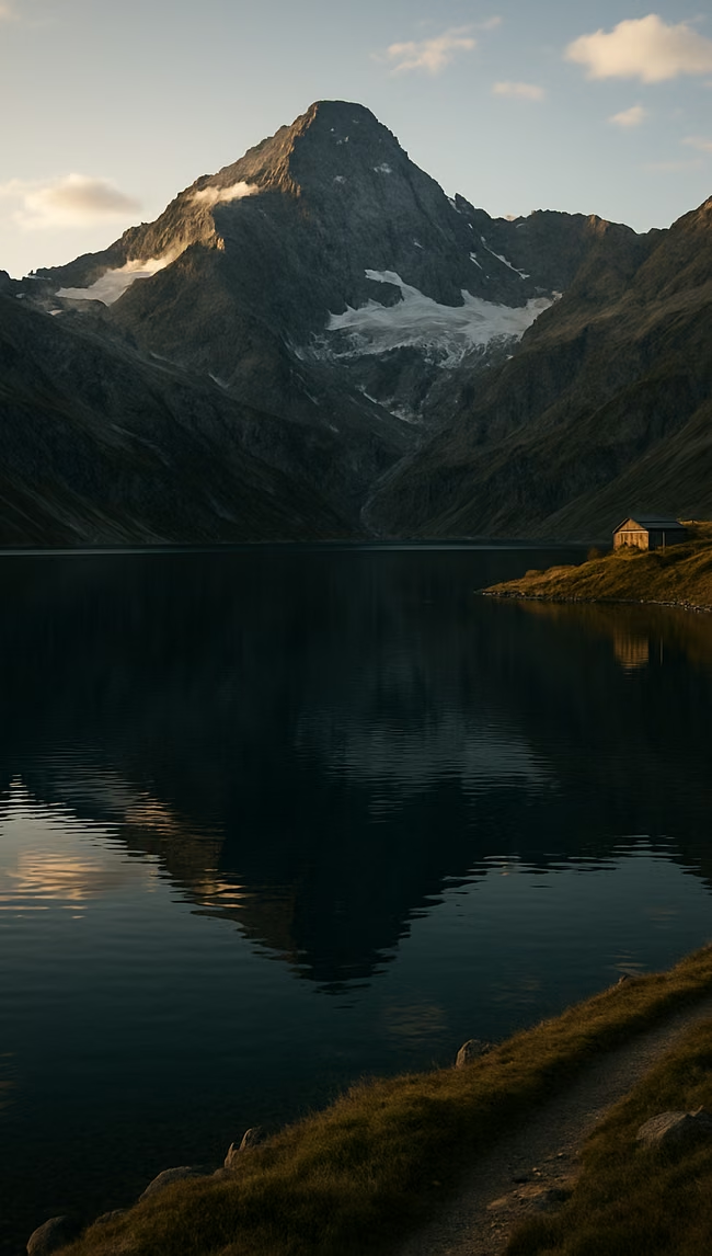
Before making any plans, bear in mind that the Muzelle hike is a real mountain route and should not be underestimated. The main trail, starting from the hamlet of L’Alleau (Venosc), is well waymarked but demanding, and it is not unusual to encounter lingering snowfields in early June or late September. The route to the refuge and lake follows a logical progression: a climb through forest, crossing clearings, then arrival in a high-altitude cirque with a breathtaking view over Lac de la Muzelle at 2,130 m.
Managing the elevation gain and the relative remoteness of the route (allow 5 to 8 hours return depending on your level) requires serious preparation: check your fitness, stay well hydrated, choose a settled weather window (afternoon storms can be severe), and book the refuge in advance. Locally, it is advisable to check weather bulletins for several days before setting off and to ask in Venosc or at the Les 2 Alpes tourist office for information on waymarking conditions or any potentially slippery sections.
For photographers, sunrise or sunset over the lake more than justifies the effort — but never compromise on safety. Finally, outside the refuge season, a tent and suitable bivouac equipment are essential if you want to attempt the adventure over two days.
To find other suitable activities: Les 2 Alpes BLOG.
Key things to know before setting off
In short, the hike to the Muzelle is ideal for those seeking an authentic Alpine experience and who are ready for sustained effort, while paying close attention to the weather and choosing the right equipment.
This guide provides further details: Hike to the Lac and Refuge de la Muzelle.
Choosing to take on this route promises sweeping views, authenticity and a real sense of achievement, provided you prepare every detail and adapt the itinerary to your current level of experience.
This resource usefully complements these tips: Hike to Lac du Lauvitel in the Écrins National Park.
On this page
01
Discover the hike to Lac de la Muzelle and the Muzelle Refuge
02
Compare routes and plan your hike
03
Get organised: budget, weather and logistics
04
Practical tips for a hassle-free trip
Extend the experience
The Resort Guide
Plan your trip by exploring the must-see attractions in Les 2 Alpes: activities, scenery, practical tips, and top spots to help you make the most of your time at the resort.
Chapter
02
Compare routes and plan your hike
Everything you need to know to make the most of the Muzelle hike, avoid mistakes and unexpected issues, whatever your experience level or the season.
Maps, access and route options from Les 2 Alpes, Venosc and beyond
There are two main access routes to reach Lac de la Muzelle and the refuge. The most popular starts in Venosc, which is easy to reach from Les 2 Alpes by gondola (in season) or by road. Allow 5 to 7 hours for the ascent, with around 1,200 m of elevation gain: the trail, waymarked as a PR route (yellow) then GR (red and white), first crosses forest before following waterfalls and opening out into the final cirque.
An alternative route starts from the village of Bourg d’Arud via the Vénosc bridge: it is slightly longer but less steep on some sections, making it a good option when the main route is busy or if you want a more gradual pace, especially with the possibility of a break in small clearings.
Some experienced hikers choose more demanding routes via surrounding passes such as the col de la Muzelle (2,613 m), which connects with the GR 54 if you are on a longer trek. Be careful, however: these variants require excellent preparation, strong navigation skills and stable conditions (residual snow is possible early in the season).
Always take an IGN Top 25 map (3336 ET Les 2 Alpes) or an up-to-date GPS app with current GR tracks — the few junctions are well signposted, but precision remains essential in the mountains. Before setting off, also check refuge availability (closed out of season, booking required in summer) and local information on trail conditions (fallen trees, slips after storms, etc.).
See also: Hiking around Les 2 Alpes: discover the best trails.
Common mistakes include underestimating the time required or the elevation gain, especially if you start the hike late in the morning. This increases the risk of being caught out by high-altitude weather, particularly sudden thunderstorms from mid-June onwards.
Another frequent oversight is water management. There is no reliable water point between the start and the refuge at the very beginning of the season; allow at least 1.5 L per person, and more during hot spells. As for bookings, the Refuge de la Muzelle is often fully booked in July and August — reserving 10 to 15 days in advance is wise, and essential if you are travelling as a group.
Do not overlook your equipment either: sturdy mountain footwear, layered clothing, walking poles (the return path can be steep and stony), and a head torch if there is any chance you may be out after dark. Finally, always tell someone your route and expected timings, even on a marked trail.
To avoid unpleasant surprises, check the Météo France forecast for the area the day before, the refuge’s official information page for alerts (https://refuges.info or the Parc national des Écrins website), and do not set off if storm warnings are in place.
One final tip: do not hesitate to ask locals or the refuge warden for advice. They know the current state of the trail and any difficulties better than anyone.
To help prepare the rest of your stay: Wellness in Les 2 Alpes: the best places to go.
Practical checks and common mistakes to avoid
Comparing the different routes helps you tailor the hike to your expectations — pace, scenery and level of difficulty — while also anticipating the small details that make all the difference once you are there.
To help anticipate the day’s conditions: Cosy, chic all-wood mountain studio.
By carefully planning access, adapting your equipment and listening to advice from local experts, you make your hike safer and can fully enjoy the wild charm of the Muzelle.
Another useful resource: official Les 2 Alpes website.
On this page
01
Discover the hike to Lac de la Muzelle and the Muzelle Refuge
02
Compare routes and plan your hike
03
Get organised: budget, weather and logistics
04
Practical tips for a hassle-free trip
Extend the experience
3600 m
Elevation of the Les 2 Alpes Glacier
Going Out in Les 2 Alpes
“The best restaurant isn't always the one with the highest rating”
Stay
A Summer in the Great Outdoors
Discover the best summer activities in Les 2 Alpes: hiking, mountain biking, high-altitude lakes, panoramic views, and mountain adventures to make the most of your stay.
Chapter
03
Get organised: budget, weather and logistics
Everything you need to know to make the most of the Muzelle hike, avoid mistakes and unexpected issues, whatever your experience level or the season.
Costs to budget for: transport, refuge, equipment and more
Planning a hike to the Muzelle means factoring in all possible costs to avoid unwelcome surprises.
Transport: From Les 2 Alpes, the most common starting point involves reaching the village of Venosc, accessible by gondola lift (approx. €7–10, adult return, 2024 fare). If the gondola is closed (out of season or due to poor weather), allow for the road detour or the use of local taxis.
Refuge: An overnight stay at the Refuge de la Muzelle varies according to age and status (booking is recommended from spring onwards). Expect 2024 prices of around €45–55 for adult half-board and €25–35 for under-18s, excluding drinks or sheet hire. Places go quickly in summer, especially at weekends: it is best to book via Refuges.Info or on the refuge website.
Equipment: If you do not have your own gear, allow for possible rental costs (€20–35/day for a backpack, boots and poles, depending on shops in Alpe de Venosc/Les 2 Alpes). Also budget for packed food (sandwiches €7–10, energy bars) for lunch breaks.
The hike to the Lac de la Muzelle and the refuge depends on snow conditions and whether the refuge is open.
Best season: The safest period runs from mid-June to mid-September. Outside this window, access to the refuge may be affected by lingering snow and official closure (always check the refuge website for up-to-date opening information).
Weather: Mountain weather changes quickly. Check the local forecast the day before and again on the morning of your hike via Météo France or Meteoblue. Severe summer thunderstorms, typical of the region, may mean you have to turn back or cancel.
Precautions: With the first cold spells or during snowmelt, the route may include muddy sections or areas made slippery by rain. Even in summer, always set off early in the morning to avoid the more unstable afternoon weather. Remember to bring waterproof clothing, a hat and an emergency blanket — conditions can change abruptly.
Seasons and weather: when to go and what precautions to take
Careful planning of both budget and timing improves the experience: by anticipating the high season and weather changes, you avoid the classic setbacks such as fully booked accommodation, a closed gondola or routes becoming impassable. Bear in mind that the Muzelle valley remains relatively isolated, so extra costs and unexpected issues are more common than around the main tourist routes. If needed, contacting the Les 2 Alpes tourist office in advance can help clear up any final doubts about transport options or equipment available to hire locally.
Logistical preparation, especially for weather and budget, is what separates a “successful” hike from one that feels like an ordeal.
Before booking your overnight stay or confirming your dates, work out all your costs in advance, not forgetting the "little extras": taxes, possible hot-water use at the refuge, coffees, and so on. If you are hiking over several days or in mid-autumn/spring, also think about waste management (an extra bag is recommended) and the actual availability of food at the refuge, which may be limited outside the main season. Finally, check the condition of the trails on Visorando or by asking the refuge wardens, so you can adjust your timing if any sections are temporarily damaged.
On this page
01
Discover the hike to Lac de la Muzelle and the Muzelle Refuge
02
Compare routes and plan your hike
03
Get organised: budget, weather and logistics
04
Practical tips for a hassle-free trip
Stay tuned on Location2alpes
A Live Preview
to get a sense of what to expect before coming to Les 2 Alpes
Updated data
24 hours a day, nonstop
8 Strategic Perspectives
about the resort, the glacier, and the peaks
Useful all year round
winter, summer, weather, events, ...
The Flavors of Les 2 Alpes
Cozy dining, mountain cuisine, terraces with panoramic views, and welcoming spots: explore our top recommendations for great dining in Les 2 Alpes.
Inspirations
“The best memories are rarely planned.”
— Local Guide
Chapter
04
Practical tips for a hassle-free trip
Everything you need to know to make the most of the Muzelle hike, avoid mistakes and unexpected issues, whatever your experience level or the season.
Local tips and official resources to check
To make the most of the Muzelle area, it is essential to rely on the right information:
Waymarking and maps: The trails are largely waymarked, but access to the col de la Muzelle or the alternative routes from the vallon de la Lavey sometimes require extra care. For the most reliable route, use IGN maps (map 3336 ET "Les Deux Alpes") and, if in doubt, download the official GPX track from OpenRunner. Ask the refuge wardens or the tourist office whether any recent works or rockfalls have made an access route impassable.
Timetables and booking: The refuge does not accept "surprise guests": book in advance (online or by calling the warden directly for specific requests, allergies or special meals), especially in July and August.
On-site services: In Venosc, only a small mini-market opens in high season. Be self-sufficient for water (allow at least 1.5L per person for the climb), sandwiches and snacks.
In an emergency: Note down the warden’s number and the mountain rescue number (Peloton de Gendarmerie de Haute Montagne – PGHM de Briançon: 04 92 21 58 58). Mobile reception is weak or non-existent at the lake: tell someone your route in advance.
- Check the weather (Météo France), trail conditions and whether the refuge is open
- Confirm your booking and meals at the refuge (mention any specific dietary requirements)
- Bring suitable equipment: hiking boots, poles, waterproof jacket, fleece, head torch, hat, gloves, first-aid kit, survival blanket, map and compass/downloaded GPX track, charged phone, power bank
- Take the water you need (minimum 1.5L, more in hot weather) and your own food for the climb
- Check the Venosc gondola timetable in advance (download the timetable from the resort website)
- Tell a friend or relative your route and estimated return times
- Carry a small bag for your rubbish (there is no waste disposal on site)
- Bring cash, as bank cards are not always accepted at altitude
Final checklist before you set off
A successful hike to the Muzelle depends as much on practical details as on fitness. For greater safety, ask locals in Venosc or the refuge warden as soon as you arrive: they are expected to report any significant changes on the trails (recent rockfalls, animal movements, sudden weather changes). If you have any doubts on the climb, stay with a group or keep within sight of other hikers.
Experience shows that the lake’s isolated location and poor network coverage mean you need to be self-sufficient — do not expect to find forgotten items or equipment for sale at the refuge.
One final point should never be overlooked: the importance of flexibility. Be ready to turn back if the weather changes, or to adapt your route based on the advice you received the day before. Never underestimate conditions on the ground, or the time needed for the climb, which varies widely depending on each person’s fitness (from 3 hrs 30 to 5 hrs on the classic ascent from Venosc).
By carefully preparing every detail in advance and keeping some room for manoeuvre, your stay at the Muzelle will above all be a memorable experience, with no unpleasant surprises or beginner’s mistakes.
On this page
01
Discover the hike to Lac de la Muzelle and the Muzelle Refuge
02
Compare routes and plan your hike
03
Get organised: budget, weather and logistics
04
Practical tips for a hassle-free trip
Location2Alpes Collection
Places we love to return to
Apartments selected for their location, comfort, and atmosphere, so you can enjoy Les 2 Alpes with complete freedom.
Plan Your Trip
to Les 2 Alpes
Discover our apartments, ideally located so you can make the most of your stay
Continue the adventure
Les plus beaux souvenirs commencent souvent après le dernier conseil
Conclusion
Preparing a hike to Lac de la Muzelle and the Muzelle refuge is all about finding the right balance between planning ahead, making choices that suit your group and trusting local information. One of the great strengths of this route is its flexibility: depending on the season, the group’s fitness level and the weather, it can work just as well as a challenging day hike or as a real mountain experience with an overnight stay in the refuge.
To give yourself the best chance of success, focus on the essentials: choose the right starting point for your fitness level, check in advance that the refuge is open and that the waymarking is up to date, and do not set off without the necessary equipment. Even when the weather looks settled, the high mountains can still spring surprises: always keep a plan B, especially the option to turn back or shorten the route in fog or if late-season snowfields remain.
Check official resources, especially the local weather forecast, and take time to speak with other hikers or the refuge warden to find out the real condition of the trails. The appeal of the Muzelle is not limited to its lake or the climb itself: make the most of it with time immersed in nature, a night at altitude or an early-morning photo outing at sunrise.
Ultimately, a successful hike comes down to preparation, caution and the simple pleasure of discovery: every choice matters, from booking the refuge to checking what is in your rucksack. By taking the time to plan ahead, you avoid unnecessary problems and greatly increase your chances of enjoying a genuine Alpine adventure that feels authentic and free from unpleasant surprises.
What's next? Choose your next step
Key Points
The right choice depends on the pace of your trip and what you're looking for.
Keep your options open for impromptu evenings out.
A well-located place to stay makes dining out and getting around easier.
Practical information
Season: Summer / Winter
Reading time: 6 min
Area: Les 2 Alpes
Altitude : 1,650 m
Audience: Families, Couples, Groups
Live webcams
LES 2 ALPES
The Glacier
3,400 m above sea level
8 HD webcams
Continuous Updates
Check the weather all year round
Check out the weather, snow conditions, and atmosphere at the resort in real time.
Frequently asked questions
Find answers to the most common questions about our products. Julia ensures transparency, efficiency, and detailed information in everything we do.
For a first experience, go with someone else and always tell someone your planned route.

Local Guide
Find the best moments from your article
The Location2alpes Blog
Discover tips, trends and ideas to help you prepare for your stay in the mountains, and discover fantastic places and addresses. Julia and the team regularly prepare new articles for you, so don't hesitate to visit our blog regularly.
Latest articles:

- Explore Les 2 Alpes
What would you like to explore ?
Get quick access to the resort's highlights, activities, top spots, and practical tips to help you plan your trip.